Documentation of Far East Petroglyphs

The goal of the project «Three-dimensional modeling of archaeological environment and sacred landscapes of the Far East» (2017-2020) – complex documentation of petroglyphs of the Lower Amur and Ussuri Rivers, as well as their landscape and cultural context.

Pieces of rock art of the Amur River region are extremely complex objects even for the researcher of petroglyphs, armed with the extended  arsenal of technical means of the beginning of the 21st century. This difficulty is due to the climate of the area, the topography of the sites, the nature of the images on the stones and is specific to each of the groups of petroglyphs.

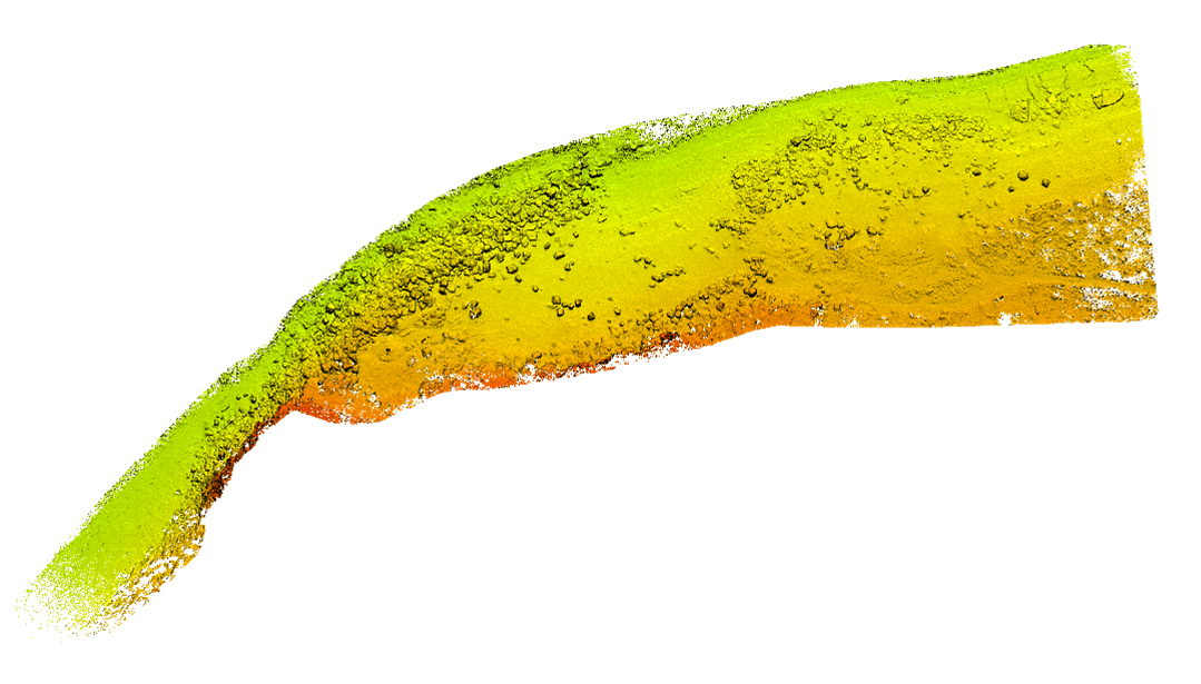
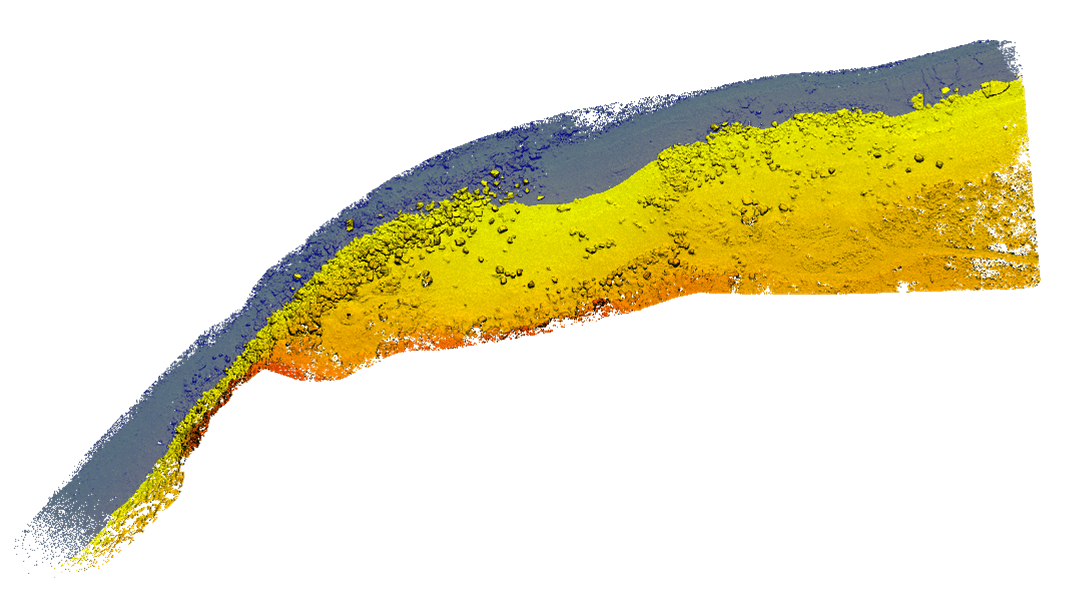
Most of the Lower Amur River petroglyphs are found on boulders located in a low flood plain and are constantly exposed to the river. From November to April, the stones are covered with snow and ice. At the end of April, an ice drift passes through Amur, which moves both the stones themselves and loose alluvial deposits. Throughout the winter, work on sites is hampered by frost and winds. After the ice drift, the water level in the river decreases for a while and the explorer has only a short period of time during which a substantial part of the petroglyph boulders is available for observation. In May and June, the level of the Amur remains relatively low, with occasional rises and declines, both natural and associated with dams on the Zeya, Bureya, and Sungari Rivers. July is the beginning of the flood, which peaks in August-September. In early November, the level drops, but the water that comes off the stones leaves a thin layer of dirt on them, which immediately freezes, and the petroglyphs once again become inaccessible until next spring. Thus, a researcher usually has no more than 15-25 days available during the year that are relatively good for documentation, and these days cannot be predicted with any precision.

Sikachi-Alyan 1 at high water. September 26, 2016.

Sikachi-Alyan 1 at low water. April 22, 2017.

Freeze up on Amur River. November 17, 2020

Ice drift on Amur River. April 21, 2019 г.

A typical example of the river’s effect on the petroglyphs of Stone 18 on Sikachi-Alyan 2. This stone, long accessible for observation (see photo 2009), was inundated with other stones during the catastrophic flooding of 2013. Floods and ice drifts continued to move surrounding stones and destroy petroglyphs over the following years.

Floodplain of Amur River at a level of 1.5 m below the normal (water at 24.6 m).
April 28, 2019.

Water at a level of 30 cm above the normal (water at 26.5 m).
April 24, 2017.

Water at a level of 3 m above the normal (water at 29.2 m).

It is difficult to document petroglyphs of the Amur River region not only because of climatic and hydrological conditions. Petroglyphs carved on basalt do not stand out on the surface of the stone by color. The edges of the grooves are usually smoothed by long-term exposure to floods and ice drifts. As a result, with the exception of the brightest and most well-preserved ones, petroglyphs are difficult to detect and document. Traditional methods (drawing on a tracing paper or other transparent material, drawing by an artist) often do not produce the desired result. Contact copies (paper squeeze prints, castings, molds) are labor-intensive in production and not always applicable to large surfaces and surfaces with complex geometry.

  • In 2019, the Amur River level on Sikachi-Alyan 2 exceeded 29.2 m in the period from July 29 to October 10. The level of the Amur River in Sikachi-Alyan 2 exceeded 29.2 m.

  • In 2020, p. Amur on Sicachi-Alyan 2 exceeded 29.2 m between 22 August 22 and October 30.

  • All stones with petroglyphs of Sicachi-Alyan 2 are completely underwater at an Amur River level 30.2 m (4 meters above the normal).

  • At the peak of the flood in 2019, the level of Amur River on Sikachi-Alyan 2 reached 32.6 m (6.4 m above the normal).

  • At the peak of the flood in 2020, the Amur River level on Sikachi-Alyan 2 reached 32.5 m (6.3 m above the normal).

The groups of locations of petroglyphs in the basin of the Ussuri River have their own peculiarities. They are also difficult to access (Sheremetyevo petroglyphs are in the state border zone, access to Kiya location is very difficult after the rains), and poisonous snakes are very active on cliffs in summer. It is difficult to identify and document petroglyphs on lichen-covered surfaces. A substantial part of the images are located at a significant height (3 to 9 meters from the foot of the cliffs), in some cases, they cannot be cleaned and documented without top rope climbing protection.