The current stage of documentation of Far East petroglyphs

«… Petroglyphs of Sakachi-Alyan turned out to be such a “fortress” which could not be taken by assault at once, but only by a long siege…»
A. P. Okladnikov, 1971

During researches 1958–2016 within the groups of petroglyphs of Sikachi-Alyan, Kiya, and Sheremetyevo, a total of more than 150 boulders and surfaces with petroglyphs were identified and described. A huge amount of work was done on a topographic survey, photographing and copying rock carvings, sketching individual boulders and cliffs with petroglyphs. Nevertheless, the incompleteness of documenting the monuments by 2015 became obvious. To solve the problem, a method of complex digital documentation was developed, based on the widespread use of modern technical means and providing not only accurate reproduction of petroglyphs but also display of their relationship with the landscape context.

The result of the documentation should be a digital image of the site, with sufficient accuracy fixing its appearance at different levels of detail (a single petroglyph, stone or surface with petroglyphs, location, group of locations, province) and reflecting the shape of individual objects, the exact position of objects and the relationship between them.  

Different detail in the display of objects implies different ways of documenting. Applied to the locations of petroglyphs of the Far East, the methodology is based on three-dimensional modeling of petroglyphs and their landscape context but does not exclude other methods. The baseline data for the simulation were collected mainly from ground-based photography (for individual boulders and petroglyphs) and aerial photography from unmanned aerial vehicles (UAVs). Limited use of laser scanning was applied only to survey rock cliffs and areas of river floodplains with shrub vegetation. Data integration and precise positioning (spatial positioning of objects) was achieved through the use of satellite geodesy techniques.

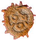
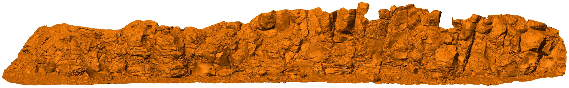
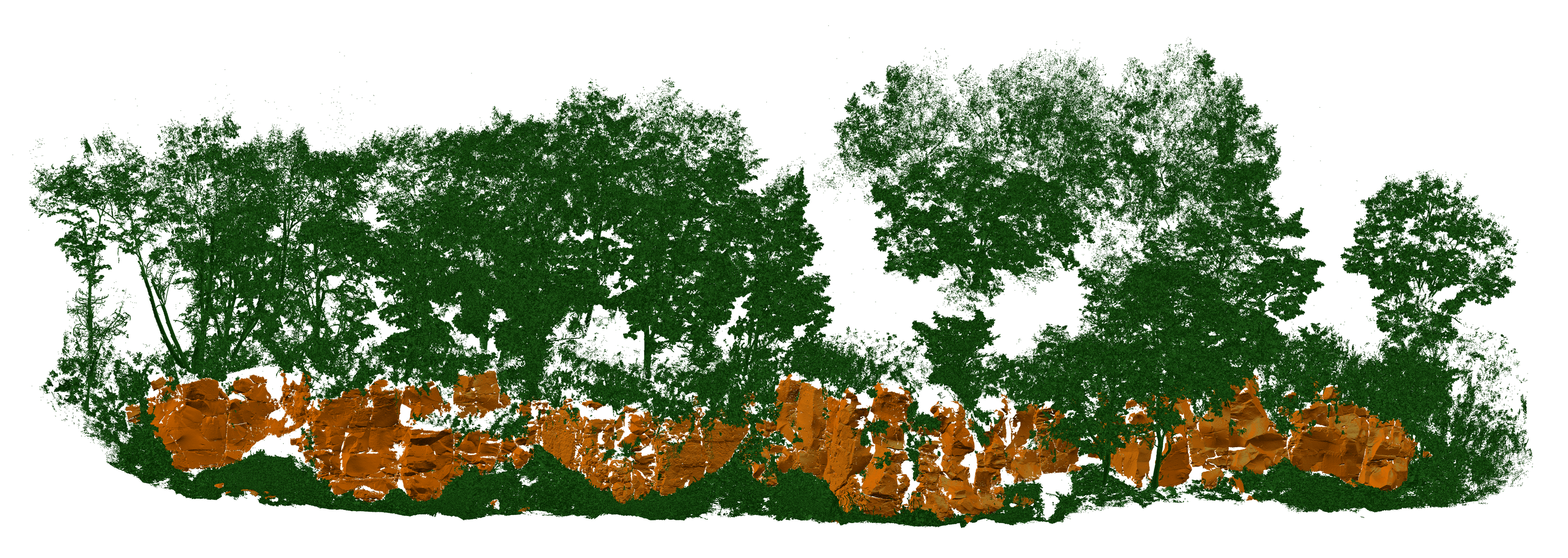
The application of technical means of documentation on the Amur region of rock art sites has a number of limitations. For example, unmanned aerial vehicles cannot be used at the locations of the Sheremetyevo group objects, as the petroglyphs are located in the state border zone. Aerial photography is complicated by tree and shrub vegetation, which does not provide good models of surfaces. Satellite geodesy is difficult to apply at locations where petroglyphs are observed on rock cliffs (Sikachi-Alyan 3, 4, Sheremetyevo 1, 2, 3, Kiya) – the cliff itself masks the satellite signal and the water surface reflects it. Topography of almost all locations (a narrow and long coastline, bounded by water’s edge and a cliff) predetermines the linear geometry of the supporting geodesic network, which is unfavorable for photogrammetric calculations.

Documenting the petroglyph landscape context

Vertical, oblique, and combined (vertical-and-oblique) aerial photography with UAVs were used in most cases to document the landscape context of petroglyph locations. Vertical photography was used to create orthophoto plans for protective zones of sites (Sikachi-Alyan 1-6, Kiya).

A combined (vertical-and-oblique) aerial photography with a UAV was used to model cliffs with petroglyphs on Sikachi-Alyan 3 and 4, as well as for detailed mapping of petroglyph boulders the distribution zones on Sikachi-Alyan 1 and 2.

In order to document the locations of the petroglyphs Sikachi-Alyan and Kiya, a total of 80 UAV missions were carried out, 21,015 aerial photographs were taken. A total of more than 110 hectares were covered by aerial photography.

Three-dimensional polygonal model of the Sheremetyevo 2 site.
Variants of presentation with photographic texture and without texture.

Oblique ground-based photography was used to map rocks with petroglyphs at Sheremetyevo 2 and 3, where the use of drones was not possible due to border zone restrictions. In such cases, the photography was carried out with a camera fixed to a telescopic rod in a range of 1-5 m and remotely controlled by radio. The experience of this survey has shown that it is well suited to producing sufficiently detailed models and that it allows better handling of recessed petroglyphs, However, it is very labor-intensive to collect data of comparable detail for a rock cliff up to 100 m long and up to 10 m high, it takes at least 2 working days compared to 1 hour of the drone survey.

The use of laser scanning of the Amur region petroglyphs has been limited. This method produces a model with an accuracy comparable to the results of photogrammetric calculations, but in practice, this model is less detailed, has more dead spaces, and has the worst photo texture. It is much more labor-intensive to collect baseline data compared to UAV and ground photography. However, laser scanning provides fairly good data on rock cliffs overgrown by shrubs. It is for that reason laser scanning was applied only in the mapping of the Kiya location (7 scans, 148.5 million laser reflection points) and, for experimental purposes, in two small areas of the Sikachi-Alyan 1 location (16 scans, 34.9 million laser reflection points). 

Laser Reflection Points Cloud
at one of the sites of Sicachi Alyan 1.
The color shows individual scans.

A cloud of laser reflection points scanning Kiya location.
The colors show individual scans.

The model (orange) of a rock cliff at the Kiya location.
Green is the vegetation (as a cloud of points).

Positioning of boulders and petroglyph surfaces

Accurate positioning (determination of the spatial position of petroglyphs relative to the world or local coordinate system) of boulders and surfaces with petroglyphs is necessary, first of all, for the reconnaissance of petroglyphs, which over time turn out to be covered with mosses and lichen, overgrown shrubbery or buried under a layer of loose alluvial deposits. Positioning is equally important for monitoring the movement of boulders under the influence of ice drifts and floods (Sikachi-Alyan 1 and 2).

The problem of accurate positioning of objects was solved in two ways. In the first case, the coordinates of points in space were determined directly by differential GNSS observations. The binding to the world coordinate system was accurate up to 10 cm. This method was used to create geodesic support networks of individual sites (34 points in total) and to position isolated boulders with petroglyphs in the Ussuri valley.

The method of direct GNSS observations provides high accuracy of positioning, but is not suitable for practical application on rock cliffs and is labor-intensive enough for mapping the distribution zones of petroglyph boulders. Moreover, in the field, it is not always possible to determine precisely which point should be taken as the center of the object, and the high-precision definition of coordinates is meaningless.

For this reason, positioning was carried out by another method, which involved the preliminary formation of an orthophoto plane or a three-dimensional model linked to the world coordinate system. In the areas of distribution of petroglyph boulders within the Amur River basin, such boulders were delineated on orthophoto planes, and the coordinates of the object were the calculated coordinates of the geometric center of this contour. The accuracy of determining the coordinates of the boulder with petroglyphs in this way is 1 m relative to the world coordinate system.

Evolution of methods and results of mapping of Sikachi-Alyan 2 petroglyphs from left to right:
Eye scan, 1969
The instrumental survey, 2003
Orthophoto planes vectorization, 2017.

The problem of positioning surfaces with petroglyphs on rock cliffs was solved in a similar way, but a point cloud or a three-dimensional polygonal model of the cliff was used as a basis for delineation, and the vectorization of surface boundaries was performed in a three-dimensional environment.

Evolution of methods and results of mapping of Sheremetyevo 2 petroglyphs, bottom-up:
An eye sketch, 1968.
Vectorization of contours according to 3D model, 2019 g.

The red square shows the same section of the cliff.

The transition from a three-dimensional rock cliff model with petroglyphs to individual surfaces with images, from left to right:
three-dimensional rock model.
contours of surfaces with petroglyphs.
detailed models of surfaces with petroglyphs.

Documentation of boulders and surfaces with petroglyphs

Three-dimensional modeling of boulders and surfaces with petroglyphs was performed by photogrammetric processing of high-resolution digital photographs. The applied technologies made it possible to form polygonal dimensional models with detail (polygon size) of 0.1-0.35 mm for a surface area up to 2 sq. m. This detail generally provides reliable identification of a poorly preserved petroglyph even on a boulder that has been exposed to water and ice for a long time. Models were then analyzed and petroglyphs selected for the creation of more detailed models with a polygon size of 0.1-0.2 mm.

Photography of petroglyphs on cliff Sheremetyevo 2.
In 2016-2019 to document boulders and surfaces with petroglyphs, a total of 58,472 photographs were taken.

To date, within the framework of the project has developed 107 boulders and petroglyphs surfaces, in addition to 51 detail areas. These materials in a simplified (faster loading) form are available in the «Catalogue of Stones and Surfaces with Petroglyphs».

In addition to documenting the boulders and surfaces with petroglyphs directly at the locations of the Amur region, a portion of the paper squeezes made by the A. P. Okladnikov expedition in 1935 and stored in the funds of the Museum of Anthropology and Ethnography RAS named after Peter the Great (Kunstkamera), was also digitized. The analysis of the paper squeezes made it possible to identify several surfaces not included by A. P. Strathnikov in publications 1968 and 1971 and draw a number of conclusions about the possibilities and limitations of using different methods in documenting specific petroglyphs of the Amur Region.

A paper squeeze of the A. P. Okladnikov Lower Amur Expedition of 1935, digitized by photogrammetric modeling.

A comparison of digitized prints with three-dimensional polygonal models of the original boulders with petroglyphs done by modern technical means made it possible to assess the degree of decay of rock images over a period of more than 80 years, since 1935 Okladnikov expedition documentation. The results of this research are presented in the article 

Results of different documentation methods:
(a) Sketch by B. Laufer, 1899.
(b) Retouched photograph of N. G. Kharlamov, 1929-30.
(c) Map of heights by A. P. Okladnikov  paper squeeze, 1935.

(d) Sketch by A. P. Okladnikov based on paper print and tracing paper, 1970.
(e) Polygonal model elevation map, 2017.
(f) Digital photograph by A. R. Laskin, 2018.

Study of models of boulders and surfaces with petroglyphs

A number of mathematical algorithms were used to visualize model surfaces, improving their «readability» and allowing to develop of small details of petroglyph geometry. Some of the algorithms are applied directly to polygonal models, some to altitude maps based on polygonal models. The main visualization methods are an emulation of the illumination and assignment of polygons of the model (or cells of the altitude map) to a prearranged color depending on their geometry. Elevation map profiling was used to determine the exact position of the boundary between treated and unprocessed stone surfaces.

The use of various three-dimensional model visualization tools makes it possible not only to form sets of raster images of petroglyphs but also to vectorize petroglyphs with precision and detail unachievable by traditional methods.

More details on the use of mathematical algorithms for the detection and vectorization of petroglyphs are discussed in the article.